Remarks:
The places written with bold characters in the text show the marked places in the Route-Altitude diagram.
You can find detailed hiking maps about this section of the Blue Trail in the Map Chapter.
I have taken more dozen panoramic views along the more than 1100km long route of the National Blue Trail. They are collected in the chapter named Panoramic views, but I put links to the pictures in the text. If you click on the links, the views will open in a new window.
There are short videos about the medieval condition of the Hungarian castles, fortresses on the Youtube. I have collected them in the Castles, fortressess chapter, but I put links to the videos in the text, as well. If you click on the links, the videos will start in new windows.
If you click on the small pictures in the text, they will open in bigger size.
A glimpse at the fort of Visegrád from the ferry
In the previous chapter we finished the hike along the western part of the Blue Trail in the small town named Visegrád, at the coast of the Duna (Danube) River. If we want to continue our hike on the other side, we have to cross the wide river. There is no bridge over the river at Visegrád, but we find a ferry station on the embankment of the Duna, the  marks lead us exactly to the ramp of the road. When we buy the tickets at the window of the small ticket office, we can boarding the ferry. The travel takes only five minutes between the two coasts of the river, but we can admire in the wide panorama of the Pilis Mountains during the voyage, and the steep Castle Hill towers above us with the old ruins of the Medieval fortress.
We can see the mountains of Pilis from the ferry. The rocks of Borjúfő are on the middle of the photo.
After the short travel we get off the ferry (Nagymaros village, ferry), climb the steeply rising ramp leading to the embankment of the Danube, turn right on the sidewalk of the Béla király sétány (King Béla Promenade) and walk until the first corner. Here we can shoot a last glance towards the wide river, and turn left onto the Magyar utca (Magyar Street). After a few hundred steps we cross the busy main road number 12 and notice the railway bridge in front of us. The railway station is located exactly on the bridge, stairs lead on its right side to the platform and to the ticket office (Nagymaros village, railway station). We can find the stamp of the Blue Trail in its small metal box on a post at the door of the ticket office. After stamping we begin the hike through the Börzsöny Mountains.
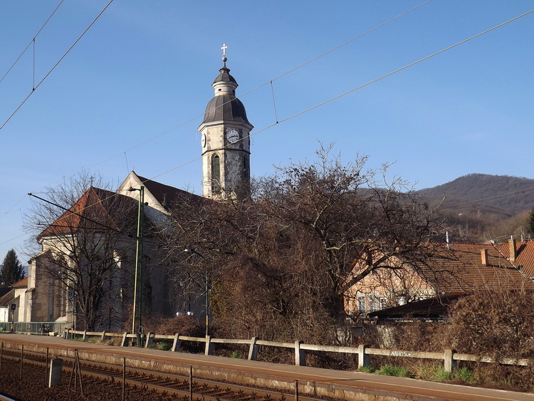
Beside the tower of the Roman Catholic church stands the Hegyes-tető Mountain
We cross the railway under the bridge and turn left at the first corner onto the Dózsa György utca (Dózsa György Street). We pass the big building of the general school, and the Roman Catholic church of the village appears on the left side of the road. The church was build in the 14th century, if we go closer, we can see the different styles of the windows: we can explore the Romanesque, Gothic and the newest, hardly 200 years old ones, too. The old windows were explored at the last big reconstruction of the old church. The sculptures of the first Hungarian King, István, and his wife Gizella stand at the farther side of the old church.
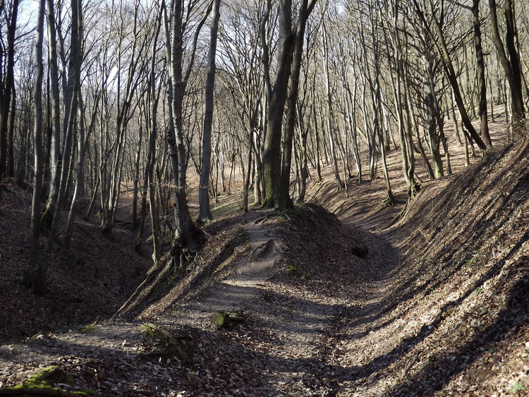
The path climbes hard in the Templom-völgy Valley
Our route turns left at the small square of the Catholic church onto the narrow Kálvária utca (Kálvária Street) later this lane joins to the long and steeply rising Diófa utca (Diófa Street). We reach the last houses of the village after a long and hard climb. The asphalt road finishes here and we step into the forest on a well-trodden footpath. Interestingly the upward slope gets milder among the trees, at the bottom of the Templom-völgy (Templom Valley). The path ascends continuously in the shady beech forest at the bottom of the vale, we reach a small plateau after about 20 minutes long walk among the trees. The trail bends towards left and we get to the edge of the plateau after a few hundred steps.
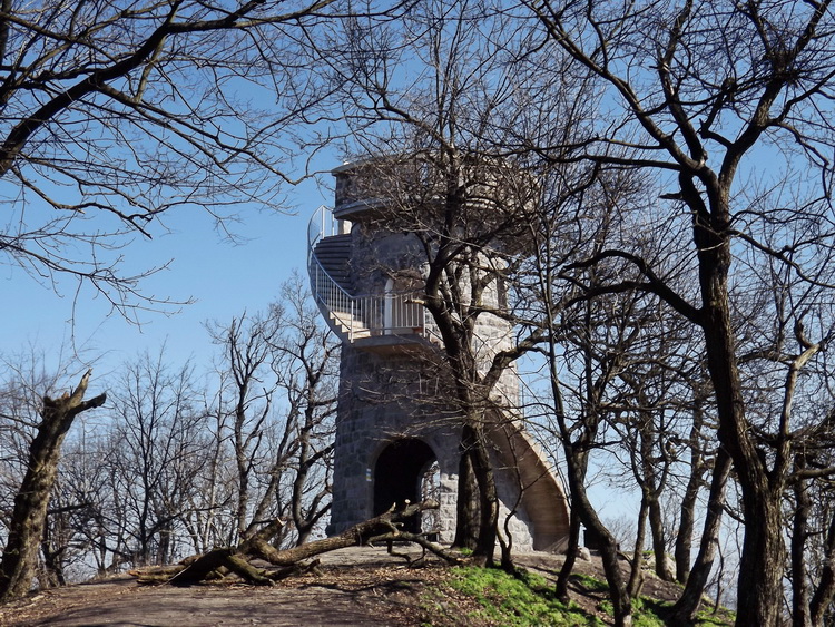
Lookout tower on the top of Hegyes-tető
The path turns right here and the climb starts again on a narrow ridge. At the junction of paths we must choose the left one, we finish the climb here, and turn off to the steep mountainside. The narrow path gets around the southern side of the Hegyes-tető Mountain, among the canopy of the trees we can glimpse the Danube, which flows already deeply below us. We climb slowly back onto the ridge, and get to the col between the Hegyes-tető and Szent Mihály-hegy Mountain. At the junction of marked paths the Blue Trail turns right, following the  marks. We pass small, fenced areas, located beside the trail, if we go closer to them, we will notice the vertical mine shafts of former, more hundred years old mines. After a few minutes long walk the climb finishes and we reach the wide meadow named Ürmös-rét. We cross it on a grassy footpath and on its other edge step into the forest again. We hike on a more and more narrower ridge, and the lookout tower appears in front of us after a few hundred steps. We climbed the 482 meter tall Hegyes-tető Mountain! (Hegyes-tető Mountain, lookout tower)
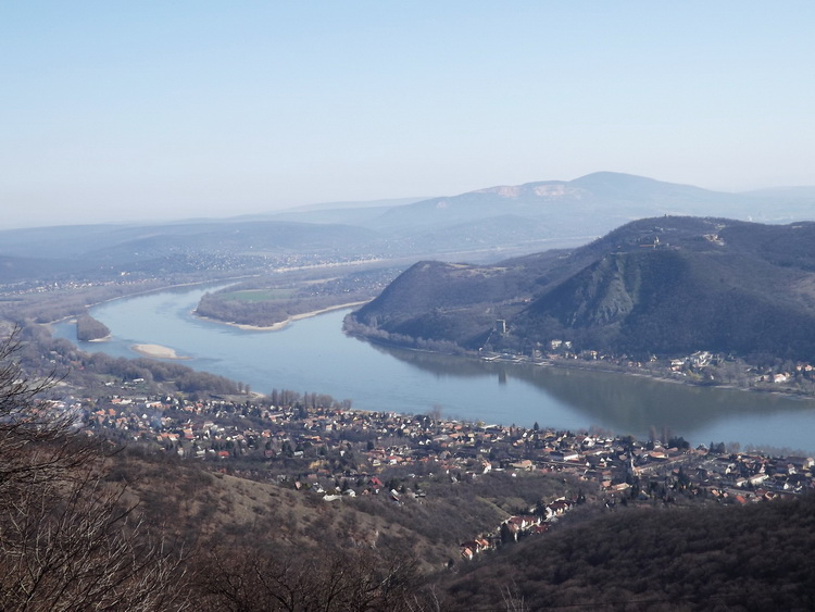
The panorama of the Danube Bend from the lookout tower
There are resting benches at the foot of the tower, but it is worth climbing the caracole stairs on the outer wall and looking around from the top level! The Hegyes-tető stands exactly in the centre of the Danube Bend, the river gets around this mountain, making a big “U” shape. We can see Nagymaros village below us, we began the hike there about one and a half hours ago. Visegrád village appears on the other side of the river, the Castle Hill towers behind it with the old, ruined fortress on its peak. If we turn towards north, we can see the 900 meter tall central peaks of Börzsöny Mountains in the far distance, we will continue our hike in that direction. (Link to the panoramic view)
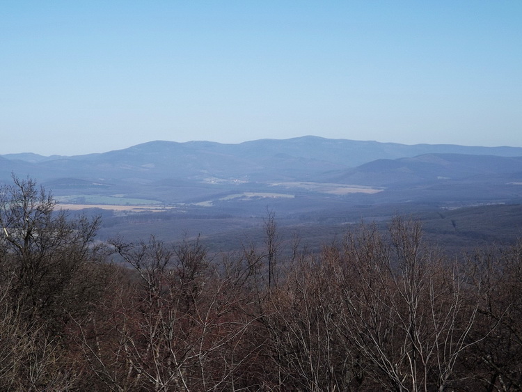
A view towards north. We will continue the hike in that direction.
The Blue Trail goes on in the northern side of the Hegyes-tető, and slopes very steeply about 100 meters to the clearing named Világos tér. We cross the big, grassy meadow on a footpath and step into the forest again. The slope continues, but it is already softer here. The trail crosses a dirt road twice, and we reach the wide meadow of Köves-mező after a 20 minutes long walk. Köves-mező (Stony Field) is a well-known picnic area at the Danube Bend, it is crowded on weekends with day-tripper families, because the meadow is accessible with car on a narrow asphalt road (Köves-mező Meadow, resting place).
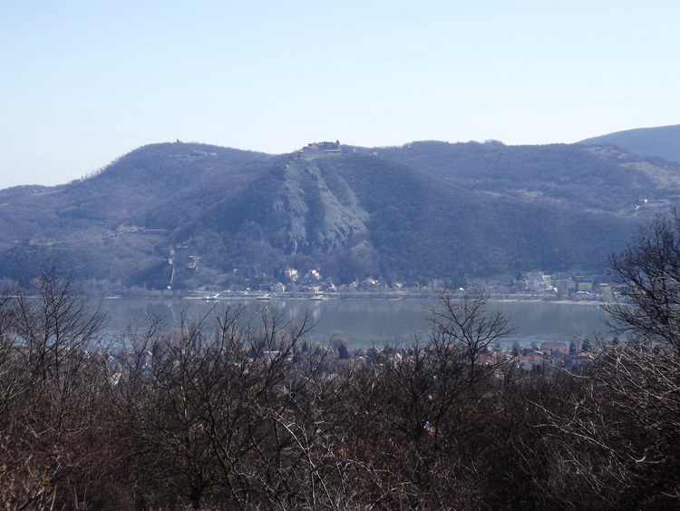
The Castle of Visegrád taken from the Köves-mező
The trail goes on parallel with the road, but it is worth walking to the eastern edge of the meadow, where a small panorama opens towards the Danube and the Castle Hill of Visegrád. The path and the asphalt road run in a wide cut-line, only a few old oaks stand on the long, grassy field. After an about quarter hour long walk the road bends towards east, but the cut-line towards west, we cross the road here and follow the long, but narrow meadow. Our path reaches the northern edge of the plateau in ten minutes. There are resting benches here, we can take a short rest and admire the nice panorama opening from this place. A wide and deep valley is located at our feet, the Vizes-árok, the plateau continues on its farther side and the central peaks of Börzsöny stand in the background. There is an information table here, which shows the name of the far mountains in a picture.
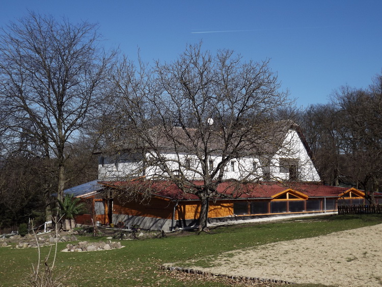
The Törökmező Tourist Hostel
The Blue Trail descends steeply into the valley, where our path joins to a wide dirt road leading at the bottom of it, parallel with a small creek. We walk for a while on its right side, later the dirt road crosses the brook and goes farther on the other side. After a few minutes the road turns away from the brook, and climbs out from the valley. We walk on the dirt road on the plateau again, among clear-cuts of different ages and forest patches. We must pay attention to the left side of the road, because the Blue Trail turns onto a narrow path before the road reaches the wide fields of Törökmező! After a few steps we reach another dirt road leading in the forest, we walk until the access road of the tourist hostels on it. We pass the adventure park and the tourist house appears in front of us. The hostel is a Blue Trail stamping place, we find the stamp in its metal box equipped on the wall at the entrance of the restaurant (Törökmező tourist hostel).
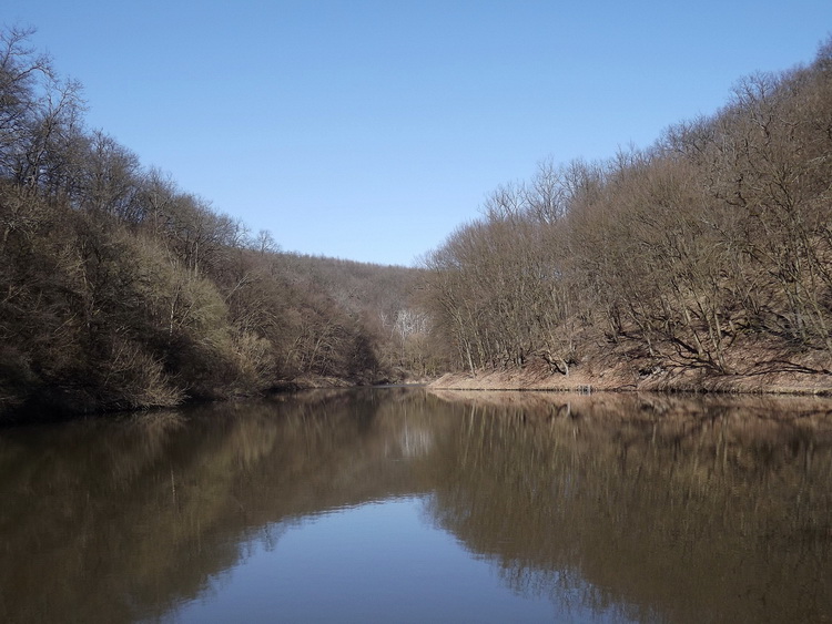
The Fishing Lake is located in the valley beside the tourist house
The Blue Trail goes around the tourist hostel, crosses a neglected field and the downhill begins on a narrow footpath into the next valley. Our path will be more and more steep, and at the bottom of the valley we cross the brook on a uncared bridge. The Blue Trail turns left onto a dirt road following the brook on the bottom of the valley, but we can take a short detour in the other direction to the Halastó (Fishing Lake). The small lake with the surrounding hills is very nice in every seasons!
If we walk back to the junction at the bridge, we take a few steps on the dirt road parallel with the creek, and turn right in next junction of dirt roads, following the painted  marks. We climb out from the valley as steep as the descending path was, but here we hike on a narrow dirt road. After fivehundred steps we reach the plateau again, the road crosses a young, dense forest here. After a while we get to the southern edge of the Békás-rét Meadow, but we don't enter the fields, because the Blue Trail turns right, onto a narrow, meandering path leading among the outermost trees. We walk on this footpath until the corner of the forest and turn onto a dirt road leading in the meadow (Békás-rét Meadow). This dirt road crosses the wide, weedy field, we can see the high peaks of the Central Börzsöny in front of us. Later the road reaches the other edge of the meadow, we walk a little while beside the trees and turn right at the north-western corner of the Békás-rét. We walk about 500 steps at the edge of the forest until a dirt road leading into the forest.
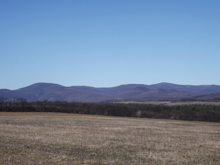
The peaks of the Central Börzsöny taken from the Békás-rét
We go about 6-8 minutes on this dirt road, but pay attention to the right side, because before a weedy clear-cut we must turn right onto a narrow path leading among the outermost trees of the forest at the edge of the clear-cut. After a few dozen steps we reach another grassy wheel tracks and cross the neglected area on them. When the road gets to the forest again, the painted  marks of the Blue Trail leave it and lead us on a narrow path parallel with the road beside an old fence at the edge of a clear-cut. After a while, at the junction of forestry roads we change side, now we are on the right side of the road. The paths are very narrow, it is difficult to follow the marks, but the trail avoids the dirt roads in this area! Its reason is simple: the rainy winter and spring is the main time of the wood-cutting, and the heavy forestry vehicles make deep and muddy tracks along these dirt roads. We walk about twenty minutes on paths, escort and cross wheel tracks and finally our route joins to the asphalt road leading toward Kóspallag village.
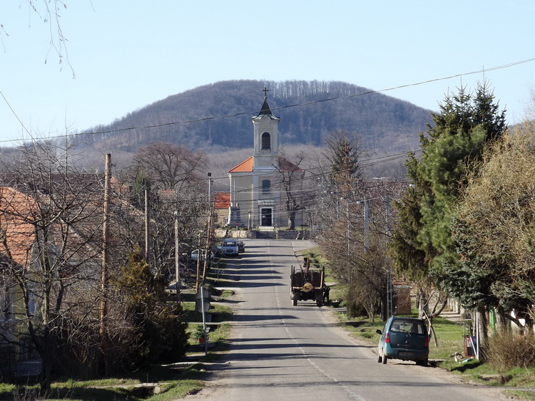
On the main street of Kóspallag village
We continue the hike on the roadside, heading northwest and after a few minutes we reach the junction of asphalt roads. There are resting benches here, and we can find a small spring beside them. The  marks run straight farther in the junction, on the narrow and very worn asphalt access road of the Rablótanya turistaház (in English: Robber Farm Tourist House :-)). Remark: The hostel works as a “key house”, so it is not open continuously, if you book accommodation, you will get its keys from the contact person. We walk about 450-500 steps on the potholed asphalt strip, and meet with the
  marks leading on a dirt road. We turn right here (the tourist house is still 500 steps on the road), the
  and
and  signs run together on this section. The dirt road leaves the forest after a while, passes the football pitch on the right side and reach the first houses of Kóspallag village. We walk on the sidewalk along the Kossuth Lajos utca (Kossuth Lajos Street) and in the junction, at the general store we turn left, onto the long and wide Szent István út (Szent István Street). We walk until the Catholic church of the village (Kóspallag village, church), turn right in the junction and pass the church on the left side. After the church we leave the asphalt road and walk farther on the narrow Kávária utca (Kálvária Street).
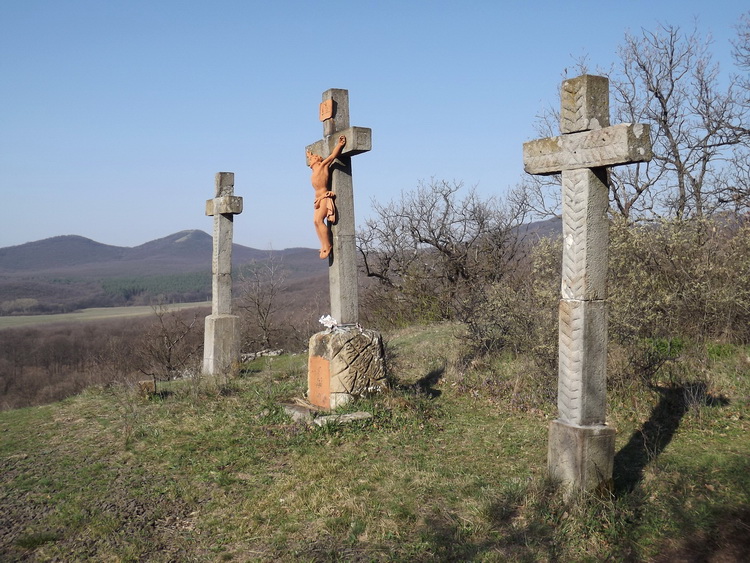
The crosses of the Calvary stand above Kóspallag
After the last dwelling houses the road continues and climbs to the Calvary crosses at the edge of the fields. It is worth to stop here and turn back, because we have a nice panorama to the village and its environs. After the crosses we reach the forest, and follow different paths and dirt roads, climb a smaller ridge and descend on the other side to the valley of the Ló-hegyi-patak Creek. We cross it and go on parallel with it in the wide valley. After a while we leave the valley, climb a few metres, pass the gardens of weekend houses and reach a narrow asphalt road. We turn right onto the road and notice the Kisinóci Tourist House beside this asphalt strip. The path of the Blue Trail turns left before the house (Kisinóci tourist house), but the Blue Trail’s stamp is located beside the house, on the wooden post of the covered terrace, at the right side of the entrance. A small restaurant is working on the terrace, but it is open only in summertime and mainly on weekends. This tourist hostel works continuously in the whole year.
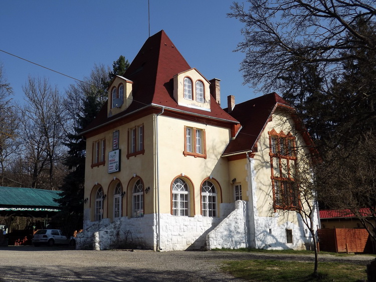
The main building of Kisinóci Tourist House
After the stamping procedure and a little rest we can continue our hike through the Börzsöny Mountains. We walk back to the narrow asphalt road, take a few steps on it, and turn right into the forest. A wide promenade leads among the oaks, after a while we reach the Pokol-völgyi-patak Creek. We cross it at the stony ford and a hard climb begins immediately among the peaks of the Central Börzsöny. The dirt road makes a few bends among the trees, later it reaches the long, straight cut-line named Inóci-vágás. About twenty years ago the cut-line led in the old oak forest, unfortunately we find more and more clear-cuts here. The dirt road ascends continuously and steeply, it follows the the wide ridge of Hálás-bérc Mountain.
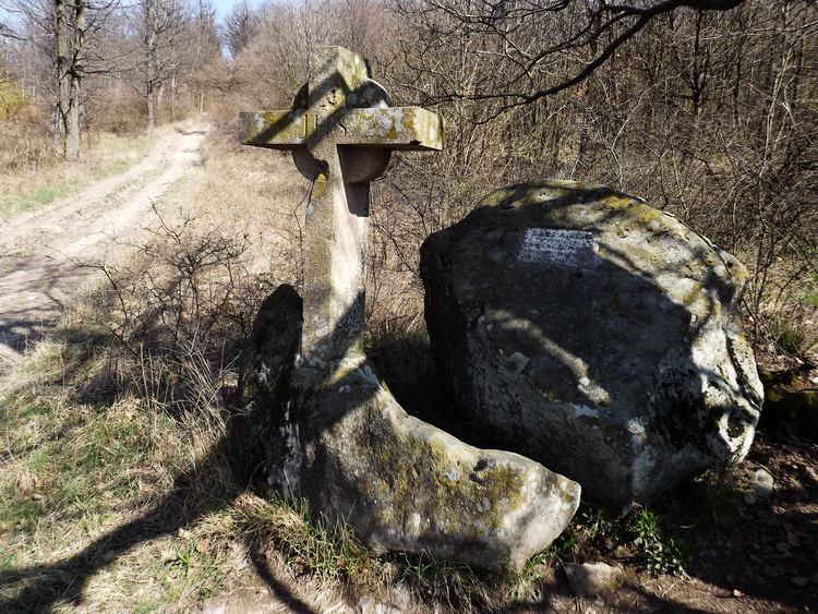
The Barna Ferenc Stone Cross stands beside the hard climbing dirt road
It is a long and a little bit boring climb, we reach the memorial cross of Barna Ferenc in a half an hour (Barna Ferenc memorial cross). The stone cross and the plaque on the rock cherish the memory of a young hiker, who died here on a hike. Now we are at the halfway of the climb in the Inóci-vágás at the stone cross, if we walk on, we will get to the upper end of the cut-line after about a half an hour long climb. The dirt road becomes more meandering, but the uphill climb won’t be less steep! Later, above 700 meter elevation the oak forest is replaced by beeches, and the climb slowly disappears, as we reach the Luczenbacher Road.
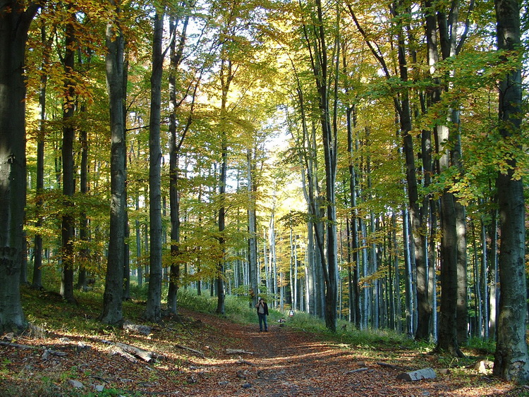
The Luczenbacher road climbs in a beech forest
We walk a little while in level, later the climb begins again and we catch a sight towards the lookout tower of the highest peak, the Csóványos through a clear-cut. After a quarter hour we get to the pebble access road of the Nagyhideghegy Tourist Hostel, we cross it here and continue our hike on a narrow footpath. After a few hundred steps we notice the pebble road again, we turn onto it, and climb until the tourist house on this meandering road, which stands exactly below the 856 meter tall peak of Nagy-Hideg-hegy Mountain. We can take a longer rest either on the sunny terrace, or in the hall of the house (Nagyhideghegyi tourist house). There is a little shop in the hall, we can buy some food or drink there. We will find the stamp of the Blue Trail beside the window of the shop, its box is equipped on the wall.
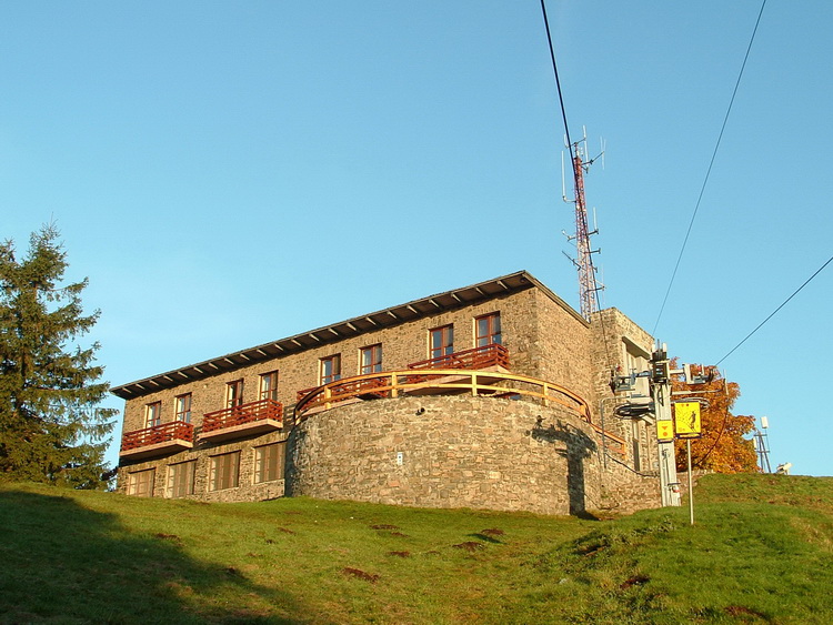
The Nagyhideghegy Tourist Hostel
The path of the Blue Trail doesn’t climb the peak, but we can see the peak stone from the promenade, where we continue the hike. Only a very limited view opens from the summit, mainly in southern direction. We reach the forest after a few dozen steps, turn right here and leave the levelling promenade. Our path slopes down to the junction of hiker paths of Rakodó Col. We pass the big wooden cross standing at the dirt road crossing and walk farther in north-eastern direction. After a short levelling section the paths begins ascend steeply, and at the end of a hard climb we reach the rocky summit of Égés-tető Peak. From this place the trail follows the narrow ridge between Nagy-Hideg-hegy and Csóványos. We pass different rocks groups along this section, later we get to a bare part of the ridge at the Szabó-kövek Rocks. A nice panorama opens here towards north and we notice the new lookout tower at the top of the Csóványos Mountain, too. It is still high above us, but we have to climb to it!
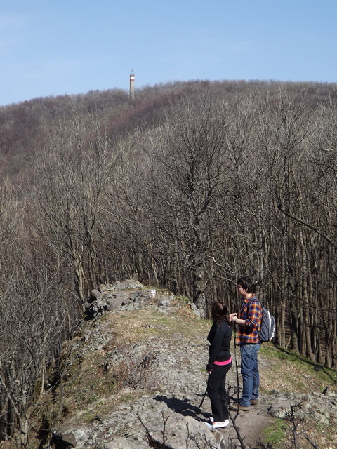
Day trippers on the ridge between the tourist house and Csóványos Mountain
The hard climb begins immediately after the Szabó-kövek in the shady forest and keeps until the peak. The Korona-kő (Crown Rock) stands below the peak, when we pass it, the climb becomes more and more softer, finally we reach the lookout tower with an easy walk (Csóványos Mountain, lookout tower). We can rest on the wooden benches on the small clearing of the summit, but it is worth climbing the tower, which was built in 2015 on the place of an old geodesical survey tower. We stand here exactly in the centre of the Börzsöny Mountains on this 938 meter tall high peak! If we look around, we can see all the lower peaks and the wide environs of the Börzsöny! Don’t miss this panorama! (Link to the panoramic view)
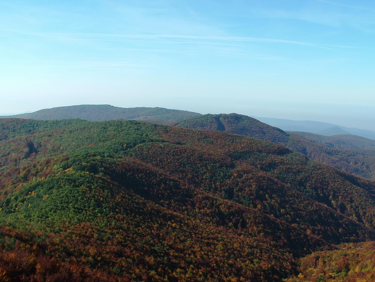
Panorama from the lookout tower of Csóványos
The descending path begins at the foot of the lookout tower, we sink very fast to the Árva-kúti-rét Meadow. Our path joins to a dirt road there, and the descent continues on the ridge of the Három-hárs Mountain. Starting from the peak of Csóványos we will reach the big clearing of the Foltán Cross Cross in a half an hour. We pass the fenced stone cross beside the wooden resting benches, and continue the sinking in a new, about 15 years of forest. Our dirt road bends from southern direction towards west, we have to find the path here, which leads toward south. The narrow, meandering path follows an old fence, pay attention to the painted  marks of the Blue Trail here! Later we reach the narrow cut-line on the long ridge of Saj-kút-bérc Mountain, and our path will follow this straight line.
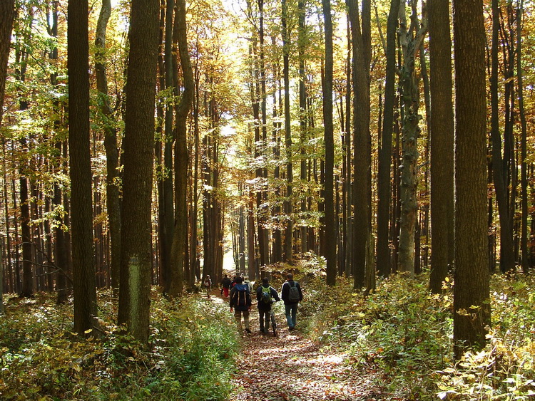
Descending road in the side of Csóványos
The path descends consistently and not too hard here, but we have to turn right after about twenty minutes, onto a levelling road. The slope slowly finishes here, we reach the feet of the Börzsöny Mountains, but the oak forest covers the environs of the mountains, as well. After a while we pass by the Saj-kút Spring, unfortunately it isn’t a permanent water supply, generally it dried up during the long and hot Hungarian summers. After the spring we cross a pebble road, and sink into the shallow valley of Szén-patak Creek.
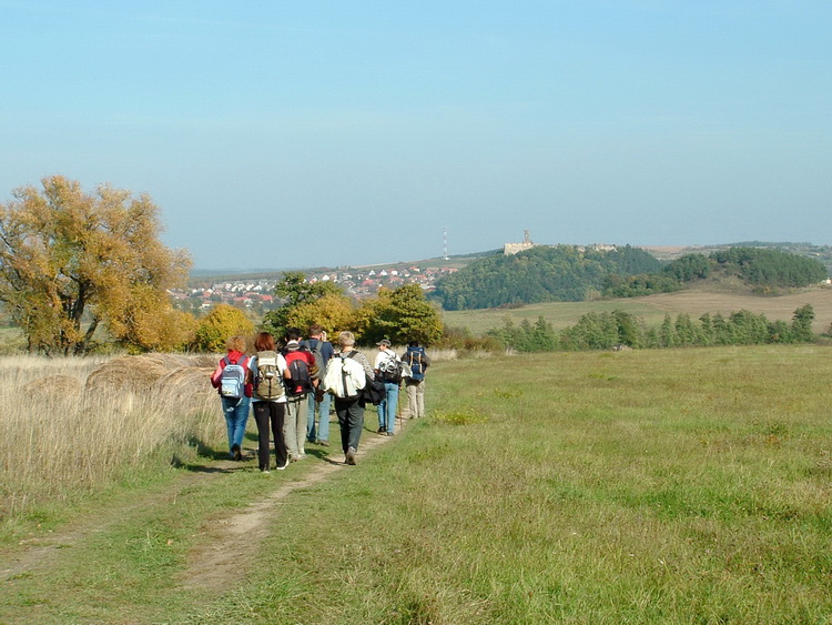
Hiker team walks on the tracks towards the Castle of Nógrád
On the other side of the stream we continue the walk in the oak forest. We will reach the edge of the forest only at the end of a one and a half hour long hike. As we approach to the finish of this section, we will meet with clear-cuts and change between dirt roads more and more often, finally we get to the wide, grassy fields of Nógrád village. We catch a sight of the ruined castle of Nógrád, the grassy wheel tracks lead towards the Castle Hill and the village, which surrounds it. (Link to the panoramic view) The dirt road crosses the fields, sinks to the ford of the Fekete-patak Creek (Crossing of Fekete-patak Brook), cross it and climb the next low hill. The dirt road bends right, towards east there. Later, after a few hundred steps the road turns left, but we keep the heading and go through the fields towards the forest covered Kálvária Hill.
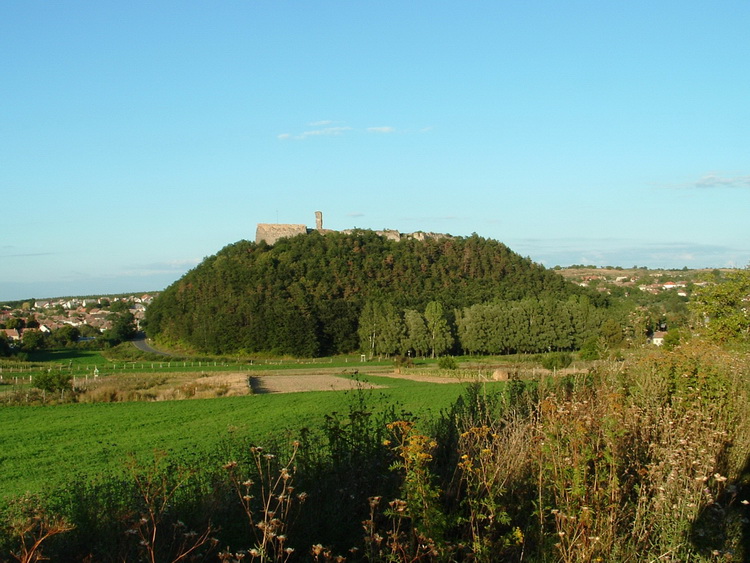
The view of the Castle Hill taken from the Blue Trail
We don’t climb it, pass an old cemetery and a small chapel at the foot of the hill, and descend to the first houses of Nógrád village. There are two permanent springs there, we can fill our flasks with cool, clean water there. A narrow asphalt road begins at the springs, we reach the railway crossing barrier on it. The marked route of the Blue Trail turns right here, onto the Kossuth Lajos utca, but we have to visit the small railway station of the village, if we want a stamp into our Blue Trail booklet (Nógrád village, railway station). The stamp is located on a hiker information board beside the station building. We finished our hike through the Börzsöny Mountains here, but if we have a little time, visit the old, ruined castle, as well! It is only a 15 minutes long walk from the railway station following the  marks on the street of the village.
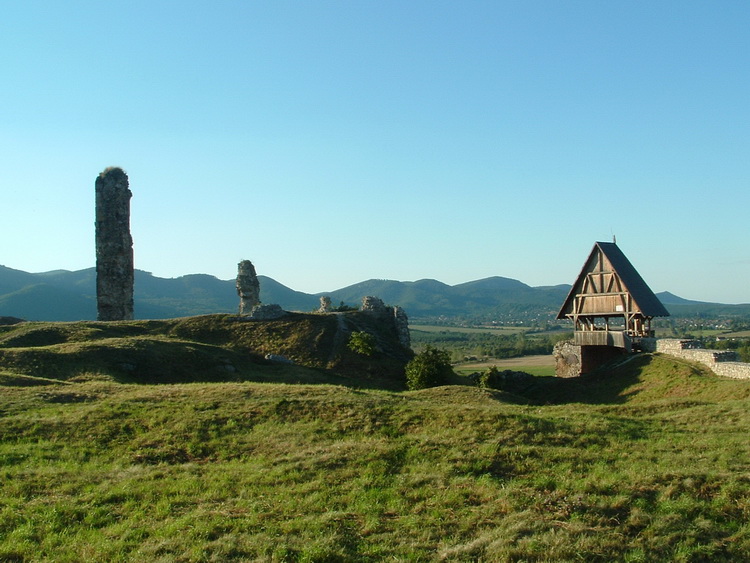
Among the ruins of Castle of Nógrád
Unlike the other Hungarian castles this fort was born not after the Tartar offensive in the second half of the 13th century, it stood already in primitive form before the Hungarian conquest in the 10th century. The first rampart fortification was built by the Slavonic tribes, the name of the village cherishes the memory of this fact: Nógrád is the distorted form of the Slavonic name „Novy Hrad” (New Castle). After the conquest was built the stone fort, it had important role in the Turk time. After long sieges the Turkey troops occupied it in 1663, but 22 years later the gun powder storage was hit by a thunderbolt and the castle burnt down. The Turks didn’t try to reconstruct the fort, they demolished the rest of the walls and left the castle. The troops of Prince Rákóczi tried to repair the fort during the Freedom War, but they didn’t have enough time, couldn’t finish the work, so when the army of the Austrian Emperor approached, they demolished the walls again. The walls of the old castle were partly renovated a few decades ago. A beautiful round panorama opens from the old walls to the environs of the village! (Link to the panoramic view) (Video about the medieval condition of the castle)
| The name of the hosting provider: | Port Kft. |
| The postal address of the hosting provider: | 9200 Mosonmagyaróvár, Szent István király út 60. |
| E-mail address of the hosting provider: | info@webtar.hu |
| The name of the author and editor of the website: | Horváth Béla |
| E-mail address of the author and editor: | horvabe1959@gmail.com |
| The information on this website is true and complete to the best of the author's knowledge. All recommendations are made without guarantee on the part of the author. The author disclaims any liability in connection with the use of this information. | |
 Creative Commons license: Attribution-NonCommercial-NoDerivatives 4.0 International Creative Commons license: Attribution-NonCommercial-NoDerivatives 4.0 International | |
| Please read the Cookie Policy of this website! It contains important information! | |

