Important!
If you would like to hike only a few days on the National Blue Trail, this chapter is not important for you. You do not have to collect the stamps of the checking points, you do not have to walk on the prescribed route, which is written in the Hiking Log and Passport (validation booklet). In this case only enjoy the walk in the nature, the beautiful views, the twittering birds and the calmness surrounding you. But if you would like to obtain the badge of the National Blue Trail after the finishing of your long hike, or the section badges of the Blue Trail, you have to keep those few rules, which are written in the official announcement of the movement.
The rules changed in 2018, you will find below both announcements. The old one is about 60 years old, it was written still in the former socialism. Those hikers must keep these rules, who purchased the older versions of the Hiking Log and Passport (with black-white map sketches), the new rules apply to those hikers, who use the 2017 edition, or newer versions of the hiking log (with coloured map sketches).
The difference is the method of stamping during the hike. This is an important distinction, please check, which rules apply to you!
The new announcement
The rules are written in this chapter apply to those hikers, who use the 2017 edition, or newer Hiking Log and Passport.The old announcement
Those hikers have to keep these rules, who have an old version of the Hiking Log and Passport.THE NEW ANNOUNCEMENT

The badge of the National Blue Trail
Engagement:
The Magyar Természetjáró Szövetség (in English: Hungarian Hikers’ Association) is the declarer and permanent manager of the movement.
Mission:
The aim of the National Blue Trail is that the participants of the movement get to know the natural beauties, counties, life of the people, the history and cultural treasures of our homeland during the systematic hiking.
Route
The trail, which is marked with blue strips, connects the checkpoints, and it is depicted in the sketches of the Hiking Log and Passport between the Írott-kő Mountain in Vas County and Hollóháza village in Borsod-Abaúj-Zemplén County. Its length is 1162.1 km. The real length and the route of the trail can be changed sometimes because of the unavoidable modifications. The modification of the route and the marking of the new section of the trail is always the job of the Magyar Természetjáró Szövetség (later: MTSZ). You can find the actual route on the http://www.kektura.hu website.
Checkpoints
Places, which are marked with small stamp symbols in the sketches, their names are written in the frames serving for the verification. The exact description of the places of the stamps is located on the http://www.kektura.hu website.
Performance conditions
The fulfilment of the National Blue Trail is allowed only on foot, from age of six, walk in any directions, divided into any amount of sections. The duration of the hike is not limited.
Validation of fulfilment
The participants have to validate the fulfilment in the original validation hiking log released by the MTSZ by stamping and dating every frame. The name of the frames and the text of the stamps, which have unique names and pictures, must be the same with the name of every frame. If this is not possible for any reason, you can validate the completion of the involved section (editor: and the reach of the checkpoint) by the methods written in the FAQ.
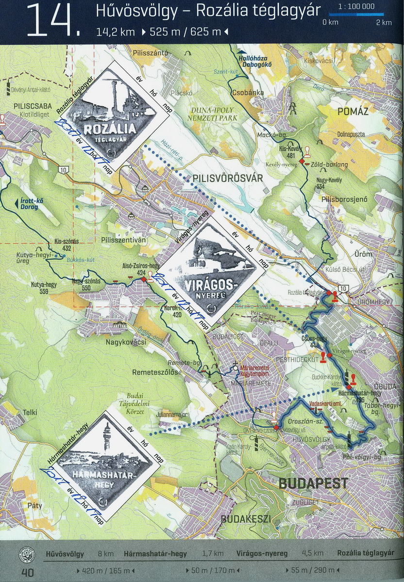
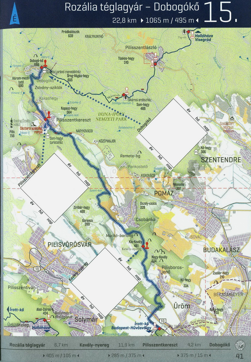
Two sheets from the newest Hiking Log and Passport. I bought it in December 2017. If you click on the pictures, they will open in a bigger size in a new window.
Record of the performers
The MTSZ has been keeping a record from the performers of the National Blue Trail since 1961. The MTSZ displays the hikers’ name, births place and date of successful performance on the official website of the National Blue Trail (http://www.kektura.hu). If you consent to display your data in the record, take a statement at the takeover of the badge, please!
Badge of the National Blue Trail
Every validated performer is entitled to wear the free, numbered badge of the National Blue Trail. The buttonhole badge, which has a similar shape, but smaller and does not have numbering, purchasable only one time. Badges are issued by the MTSZ.
THE ANNOUNCEMENT OF JUNIOR BLUE TRAIL HIKE
Junior hikers between the age of six and fourteen can perform the Junior Blue Trail Hike (in Hungarian: Gyermekkéktúra).
If the completed length of the route reaches the 300 km, the young performer can get the badge of the Junior Blue Trail Hike.
Those hikers between the age of six and fourteen, who performs minimum 50 km on the trail of a county section with justification, can get the county section badge, too (editor: the distance is counted among the checking points, where the hikers collected the stamps).
The county sections are the following:
- Kőszegi-hegység – Kemeneshát (Kőszeg Mountains and Kemeneshát Region)
- Balaton-felvidék (Balaton Uplands)
- Bakony (Bakony Mountains)
- Vértes – Gerecse (Vértes Mountains and Gerecse Hilly Country)
- Pilis – Budai-hegység (Pilis and Buda Mountains)
- Börzsöny – Cserhát (Börzsönx Mountains and Cserhát Hilly Country)
- Mátra (Mátra Mountains)
- Bükk – Aggteleki-hegység (Bükk and Aggtelek Mountains)
- Cserehát – Zempléni-hegység (Cserehát Hilly Country and Zemplén Mountains)
Participants can obtain only one badge for the completion of a county section, independently from the done kilometres.
Participants can obtain the badge of the Junior Blue Trail Hike and the county badges independently from each other.
The system of validation at the Junior Blue Trail Hike is the same as the National Blue Trail.
The completed distance in the frame of Junior Blue Trail Hike may be included in the performance of the National Blue Trail, too.
Participants can get the badge of the Junior Blue Trail Hike and the badges of the county sections at the Magyar Természetjáró Szövetség after validated completion.
FREQUENTLY ASKED QUESTIONS (FAQ)
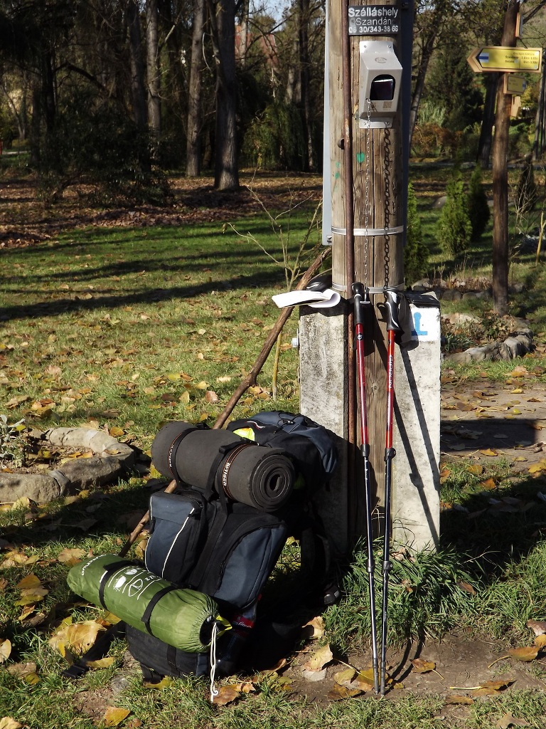
Stamping place in Szandaváralja village
Who can be the performer of the National Blue Trail?
Anybody can hike freely the whole route of the National Blue Trail, but the hiker becomes official performer only by the compliance of the rules of the announcement – which are located in the hiking log, too.
Where do hikers stamp into the hiking log?
Hikers have to stamp on those places, where the empty frames in the hiking log serving to stamp, show this. They have to use the unique stamps of the National Blue Trail, which contain the exact name of the place and a small, specific picture. There are places, where many stamps are located close to each other with the same name and graphic. Of course, it is enough to use only one stamp in this case. The stamps with same name and picture are connected to each other with a thin line on the sketches. If hikers would like to collect other souvenir stamps, they can do it on the last pages of the Hiking Log and Passport, they are reserved for notes and souvenir stamps.
What is needed at stamping?
Hikers should carry an inking pad because they are not at the stamping places. Its size should be bigger, than 30 X 30 mm (editor: it the size of the stamps). Hikers should carry a pen to write the date beside the boxes of stamps in the brochure.
What can I do, if stamping is not possible at the checking point?
When the stamping is not possible with the official stamps of the Blue Trail, other stamps are good, as well, if they contain the name of the checking point, or the name of the settlement, which is closest to the stamping point.
Is it mandatory to write the date beside the print of stamp?
Yes, you have to write the date of stamping onto the marked place.
What should I do, if I interrupt the hike somewhere?
If you interrupt the hike at a checking point and continue it later (or you reach the point again from another direction), write the second date onto the second marked place beside the box of the stamp. The second stamp is not necessary. Interruption is when you continue the hike after a more than one-day rest.
Is it possible to collect the validation for more people in one hiking log, or is it allowed to hand over the hiking log to others, if I do not want to continue the fulfilment?
No. Every Hiking Log and Passport is registered for one name and person, so the fulfilment connects to one person. The name can not be changed during the fulfilment, the booklet can not be transferred to another person.
Is it any time limit to use the stamps of an old hiking log, if meanwhile a new booklet is already released, or the route of the Blue Trail has changed?
You can continue the validation of the fulfilment in the old hiking log, in that case, if the MTSZ issued a new edition. If a section, which changed later, is already validated in the booklet, you do not have to walk the new, changed route again. It is also not required to stamp at the new stamping places. The updated, exact list of stamping places is located on the www.kektura.hu website. (editor: If you have an old hiking log, it does not contain the new checking places, which are established after its release. Unfortunately, in this case, you have to stamp at the new checking points, although your old hiking log does not show them. So it is recommended the download of the list of checking point from the mentioned website!)
How can I approach the trailhead or the starting point of the hike?
If you can do it, use the public transport! The starting and finishing points of the 27 section of the Blue Trail, which are written in the hiking log, are good accessibility with public transport. The MTSZ recommends these places to begin or finish a hike. It is not mandatory to keep this subdivision, you can interrupt, or continue the hike along the Blue Trail everywhere, but according to experiences, it is worth planning the interruption of the hike at a checking point.
What should I do, if I notice any obstacle or danger on the route of the National Blue Trail?
If you notice any problem, which can hinder the safety fulfilment of the route (eg. logging, road closure, erosion by rain, etc.), or you meet with missing, damaged stamp, write an e-mail to the MTSZ with the exact description of the place and the problem to the bejelentes@termeszetjaro.hu address. You can send your further remarks to this e-mail address, as well.
THE OLD ANNOUNCEMENT
(In brackets you can see the editor's comments)
- The aim of the National Blue Trail Movement (OKT): The participants of the tour should do sport activity frequently by walking on the route, learn about the life, development and natural beauty of our country, see the everyday life of the different regions, become familiar with the history, and hydrography of the country
- The leader of the movement: the Hungarian Hikers’ Association (MTSZ).
- The route of the tour: the National Blue Trail goes between the Irott-kő Mountain of Vas County and Village Hollóháza in Borsod-Abauj-Zemplén County, which is signed with blue stripe marks throughout 1128 kilometres and it is sketched and signed in details in the Hiking Log and Passport.
- Checkpoints: They are those places or settlements which are marked on the sketches of the hiking log, the names of these places are in the framed boxes, which are for the verifications.
- Completion of the tour: you can complete it in groups or alone from age of 6, regardless of the nationality, in any direction, divided in any amount of sections on foot or by ski (in all variation). The date and duration of the hike are not limited.
- The validation of completion: The participant has to validate the completion of the tour, the reach of every checkpoint. You can do this usually with dating and stamping of the appropriate box in the Hiking Log and Passport. It is needed to stamp at every checkpoint. If this is not possible, it is accepted the stamp of the closest place to the route which is not marked in the brochure. It is necessary to stamp at the start and at the finish of a tour. (Usually, you have to start or finish a trip at a checkpoint. So you have to stamp twice at the same checkpoint: at the finish of a section and at the start of the next section if these are in two different dates. If this checkpoint is at the limit of an official Blue Trail's section, you can find two boxes at this checkpoint in the Hiking Log and Passport. In another case, you can find only one box, but you have to stamp twice: first in the box and later above or below it - where you can find enough place. Of course, if you only reach a checkpoint and you go further, one stamp is enough.)
Photos are accepted if the place and the person together can be clearly recognised. After the completion of the whole path of the trail, it is necessary to take the personal completion brochure to the competent nature friend committee in Budapest or in the country, where the completion will be checked and validated, then they will hand over the badge. - The badge of Blue Trail: Anyone, who completes the Blue Tail, obtains the Blue Trail Badge of MTSZ, which is free of charge to that person, who has valid certificate about the membership in MTSZ. Without this certificate, it is necessary to pay the actual product price of the badge. The badge is in an irregular quadrangle with a road leading towards mountains with a blue marked column and below in red stripe with the following: “Országos Kék-túra MTSZ”. The MTSZ publishes and hands over the badge - if it is possible - with a small ceremony. It keeps a record of the people, who completed the Blue Trail.
- It is possible to complete the Blue Tail many times. In this case, it is necessary to buy the budge.
- The MTSZ has announced the Junior Blue Trail Hike (GYKT) with a reduced 300 km distance for the junior hikers between 6 and 14, which is divided into 9 regions:
- Kőszeg Mountain - Kemeneshát
- Highland of Balaton
- Bakony Mountains
- Vértes Mountains - Gerecse Hills
- Pilis Mountains - Buda Hills
- Börzsöny Mountains - Cserhát Hills
- Mátra Mountains
- Bükk Mountains - Aggtelek Hills
- Cserehát Hills - Zemplén Mountains
If the participants have done at least 50 km distance in a county, they obtain the regional badge of Junior Blue Trail Hike (GYKT). If the length of the done sections reaches the 300 km, the junior hikers obtain a badge of GYKT. In case of organising and leading a group, the leader can obtain the badge, if the number of junior hikers at least 6 (the payment of the badge: see point 7).
The participants can get in one region only one badge, independently of the done distance. (The length of a region appr. 100 - 150 km. If a junior hiker already has a badge in a region, because he/she has done at least 50 km in this region, he/she won't get a newer budge, if he/she takes trips in further 50 km length in this region.)
These conditions are valid at the badge for the GYKT, as well.
The done distance in the GYKT may be included in the OKT, as well. The validation of completion is the same as in the OKT. - Other issues: The route of the OKT cannot be changed by the county ramblers organisations, other local branches or people. The suggestion or demands have to be forwarded to the MTSZ. (The MTSZ is the only authorised organisation to make any changes in the route)
SOME PIECES OF ADVICE
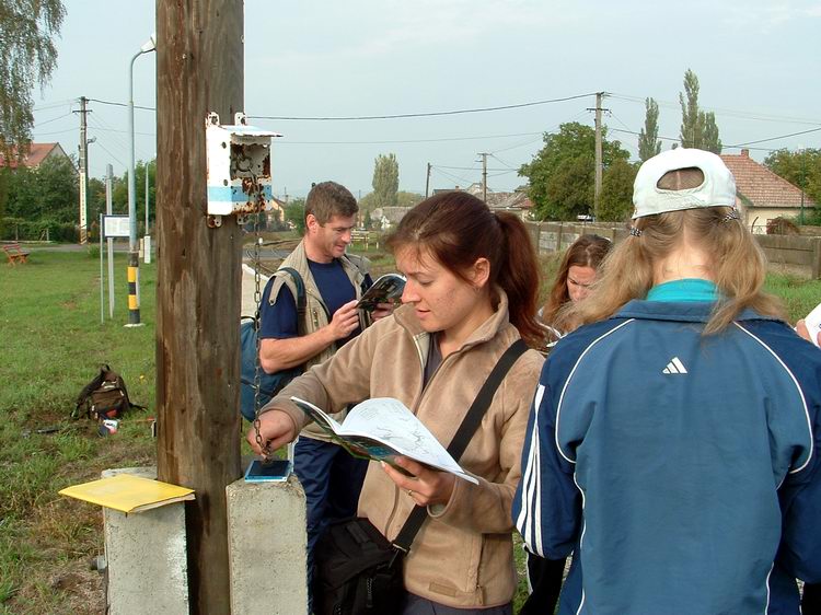
Hiker team at the stamping point of Bélapátfalva settlement
That section of the trail, which is completed and it is validated with stamp according to an earlier published personal completion brochure - so it was valid in the time of the completion - is not necessary to complete and to stamp again according to a newer brochure. On the other hand, it is not advisable to begin and to complete a changed or closed section, because there are no stamps on the checkpoints and the route can go through closed or restricted areas or it is not passable because of other causes.
It is necessary to stamp on that place (in the village, at the railway station, tourist hostel, forester's lodge), where this is prescribed in the appropriate box of the Hiking Log and Passport. On those railway stations, which names are in bracket (in the Hiking Log and Passport), you have to stamp only if the start or finish of a trip is on that place. The distance between these buildings and the Blue Trail's route is bigger than 0.5 km. (A lot of people - including me - think, that we should stamp into all of the boxes because the personal completion brochure will be complete only in this way. But this is only our opinion.)
You can find two sheets of my Hiking Log and Passport here in the following. If you click onto the pictures, they will open in a bigger size.
You always have to use the stamp of the Hungarian Hikers’ Association (MTSZ) or at the railway stations, you have to ask for the dated circle stamp of the stations. Appropriate verification could be the stamp of any company, establishment, local government, school, drug store, an agricultural cooperative, community centre, committee or contractor, on which appears the name of the stamping place. It is possible to get a dated (cancellation) stamp in the post offices, but in that case, the Hungarian Post may ask you to buy one (sticking) stamp in the brochure.
(This is a very important thing. Unfortunately - very rarely - the stamps of the MTSZ are stolen, or broken. Only in this case, the MTSZ accepts the use of other stamps. But there is a website, where you can find the stamps' conditions of every checkpoint: HERE. Unfortunately, this site is available only in the Hungarian language. We, hikers always keep this site updated.)
Although this stamping process can be helped by the Hungarian National Railroad Company (MÁV) and with a lot of other contractors, don't take it for granted.
It is useful to bring a stamping (inking) pad on the hike because the ink supply of the stamps on the area is not realisable.
It is possible in many places, that those buildings that marked in the boxes of the brochure as tourist hostel (tourist shelter), have another function (for example restaurants, holiday resort, etc.), or they are under reconstruction at this moment. The reason for this thing is the following: these types of changes are very frequent and it is not possible to correct the brochure permanently.
In that case, if it is not possible to complete the section on the signed route because of unexpected difficulties (for example mining, woodman's cutting work, closed route, erosion by the rainfall, etc), please tell the exact place to the Walking Tour Committee of the Hungarian Hikers’ Association (MTSZ).
Please, also tell Walking Tour Committee of MTSZ other problems found on the route.
| The name of the hosting provider: | Port Kft. |
| The postal address of the hosting provider: | 9200 Mosonmagyaróvár, Szent István király út 60. |
| E-mail address of the hosting provider: | info@webtar.hu |
| The name of the author and editor of the website: | Horváth Béla |
| E-mail address of the author and editor: | horvabe1959@gmail.com |
| The information on this website is true and complete to the best of the author's knowledge. All recommendations are made without guarantee on the part of the author. The author disclaims any liability in connection with the use of this information. | |
 Creative Commons license: Attribution-NonCommercial-NoDerivatives 4.0 International Creative Commons license: Attribution-NonCommercial-NoDerivatives 4.0 International | |
| Please read the Cookie Policy of this website! It contains important information! | |

